


Rainy Days Rain Radar

Rainy Days Rain Radar介绍
If you have questions, problems, feedback, please send me an email.
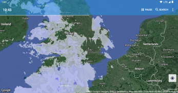
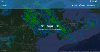
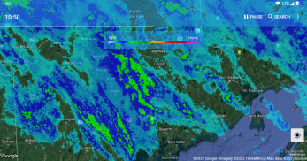
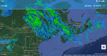
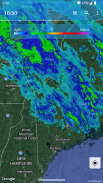
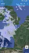
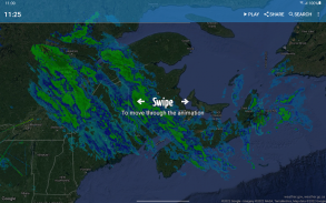
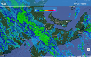
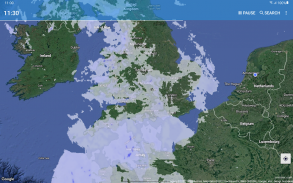
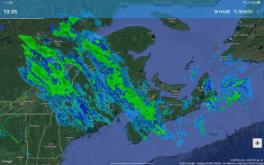
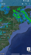
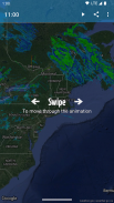
Rainy Days shows you weather radar doppler observations from multiple sources on a fully interactive map. You can zoom in, pan and search for locations.
Rainy Days uses multiple sources of data, not one map for the whole world. This gives you the most recent data for your location. Therefore, Rainy Days works best when zooming in to your local area.
Rainy Days uses real doppler observations and only falls back to satellite sourced data for areas without any doppler radars present.
Predict the weather with Rainy Days: see how storms are moving to see if they are heading for you.
Coverage: Europe, Scandinavia, USA incl Alaska, Canada, Hawaii, Puerto Rico, Africa, Australia
Note: shows rain (radar reflectivity), not clouds!
If something is not working on your device, please send me an email, adding a comment doesn't give me enough information to fix any bugs!
如果您有任何疑问,问题或反馈,请给我发送电子邮件。
雨天在完全互动的地图上向您显示来自多个来源的天气雷达多普勒观测。您可以放大,平移和搜索位置。
雨天使用多种数据来源,而不是整个世界的一张地图。这为您提供了您所在位置的最新数据。因此,“雨天”在放大到您的本地区域时效果最佳。
雨天使用真实的多普勒观测,仅退回没有多普勒雷达存在的区域的卫星数据。
使用“阴雨天”预测天气:查看暴风雨如何移动,看看是否正向您驶去。
覆盖范围:欧洲,斯堪的那维亚,美国,包括阿拉斯加,加拿大,夏威夷,波多黎各,非洲,澳大利亚
注意:显示雨(雷达反射率),而不是云!
如果您的设备无法正常工作,请给我发送电子邮件,添加评论并没有给我足够的信息来修复所有错误!
Rainy Days Rain Radar - 版本3.1.18
(15-02-2024)
Rainy Days Rain Radar - APK信息
APK版本: 3.1.18程序包: com.neenbedankt.rainydaysRainy Days Rain Radar的最新版本
其他版本

![勇闯死人谷 [Into the Dead]](https://cdn6.aptoide.com/imgs/3/4/d/34df5fe7fab8efc173a278bf1fcb4d73_fgraphic.png?w=404&h=228)


同类应用


